


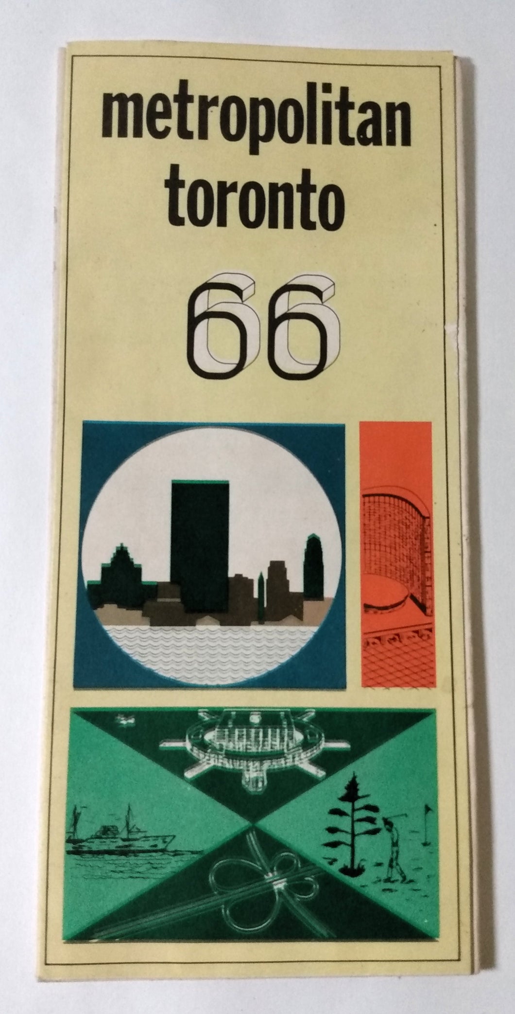


Product Description
Fold out information brochure and map published by the Metropolitan Toronto Planning Board in 1966. Folds out to a size of 24"x18".
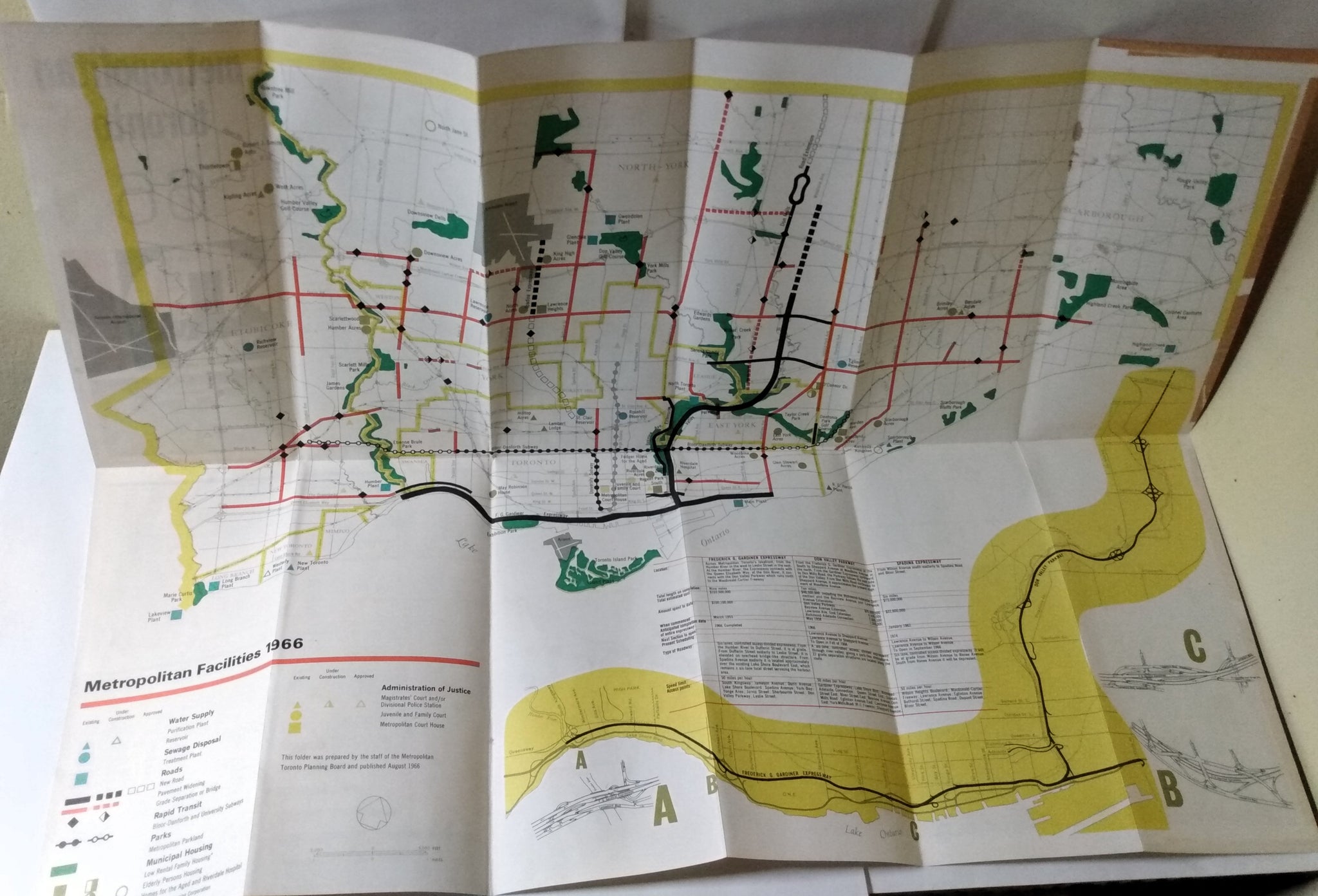
Side 1 has a map of metropolitan Toronto showing Metropolitan Facilities like water supply, roads, sewage disposal, rapid transit, municipal housing, police and court houses, and parks. There is also an info table showing details on 3 major expressways (Frederick G. Gardner Expressway, Don Valley Parkway, Spadina Expressway).
Side 2 has various info panels:
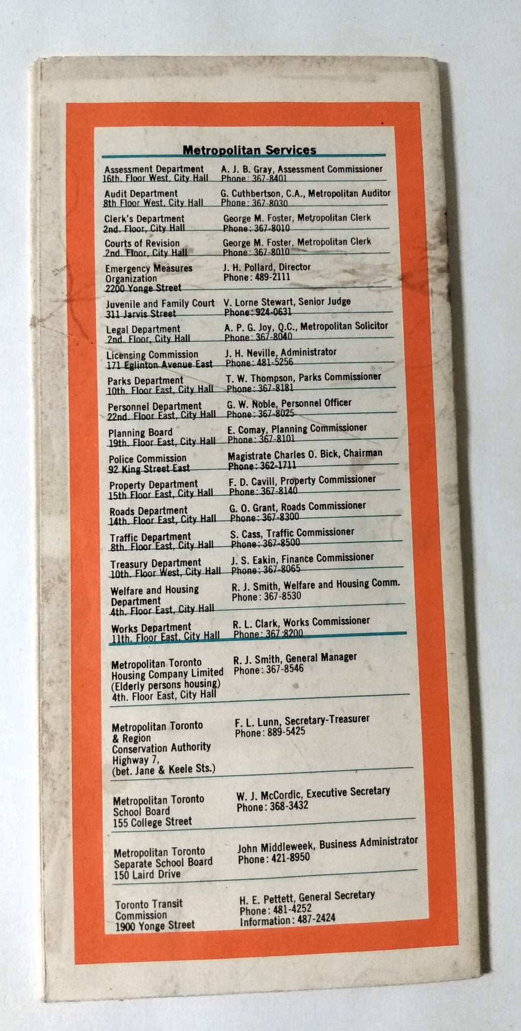
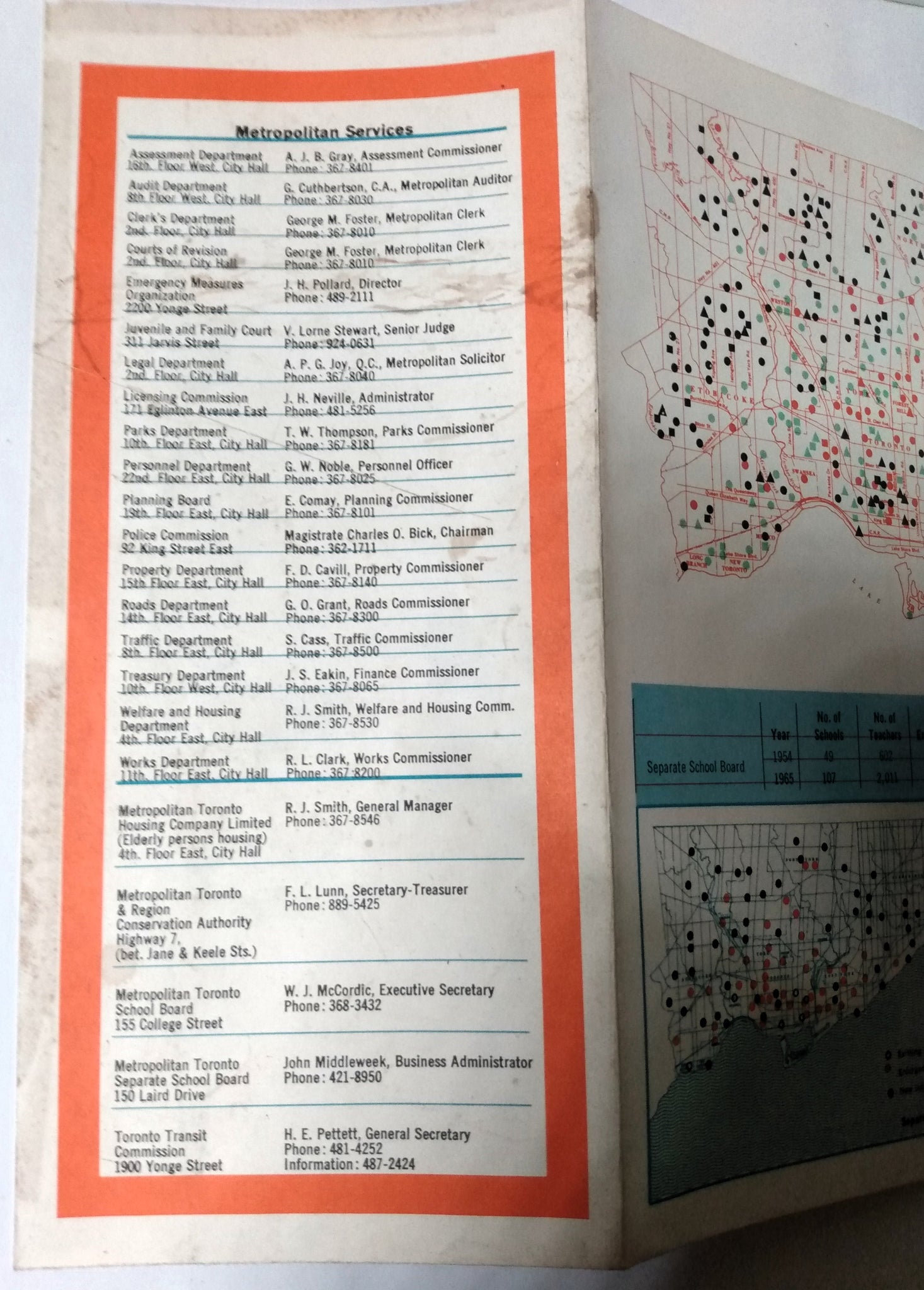
- Metropolitan Services listing
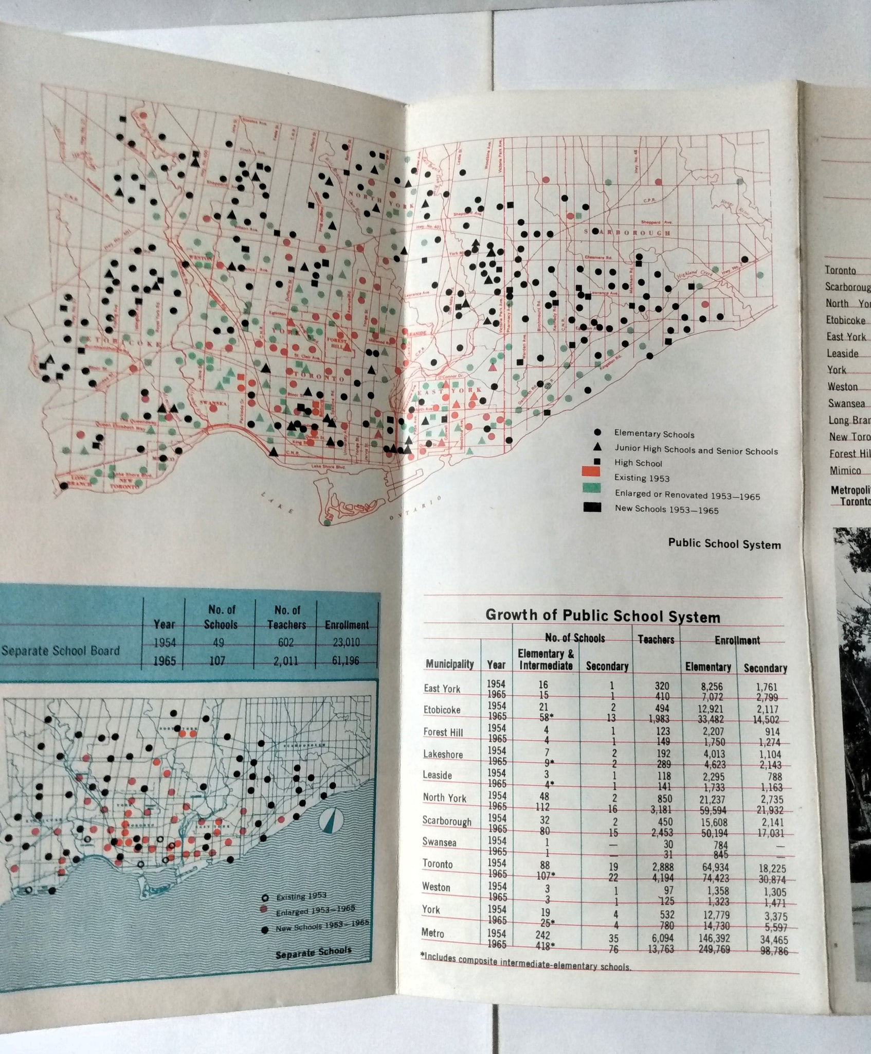
- Map showing the public school system and a chart showing the growth of the school system in local municipalities
- A chart showing facts about parks in Metropolitan Toronto with 2 photos
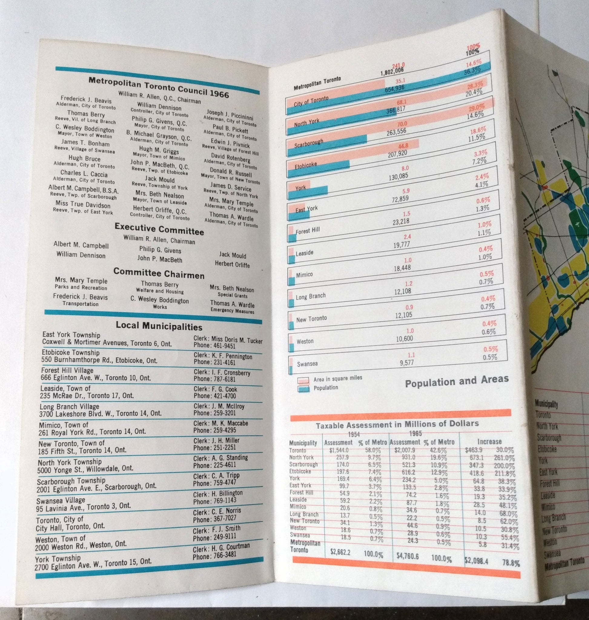
- A listing of Metropolitan Toronto Council members in 1966 and contact info for local municipalities
- Tables showing population and area size of local municipalities, and taxable assessments of localities
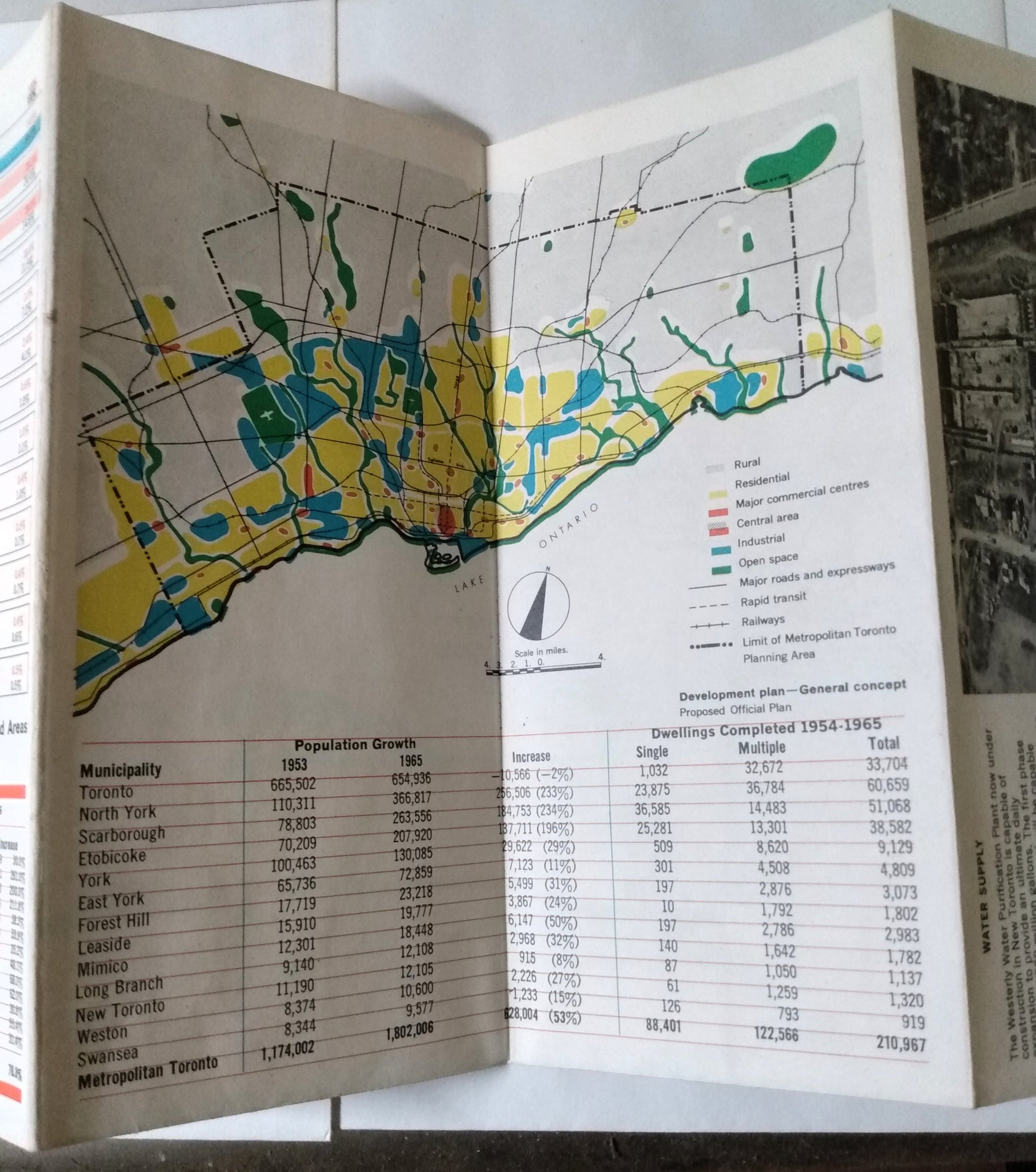
- A table and map showing population growth and new dwellings completed
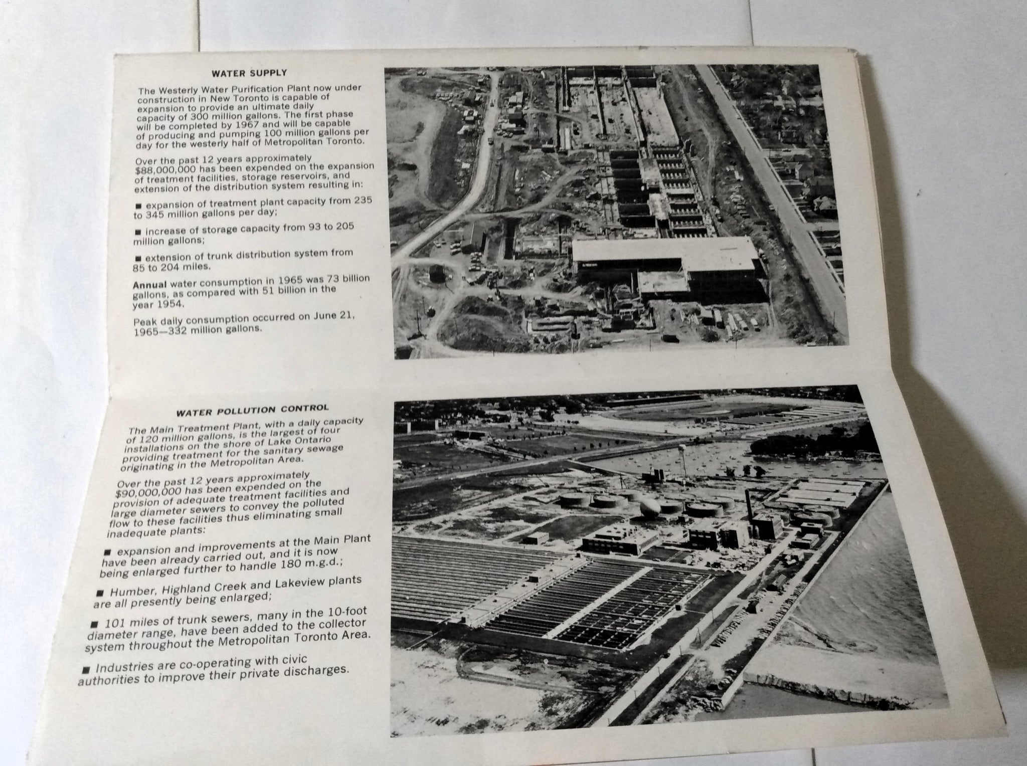
- 2 info panels with facts and photos on water supply and water pollution control.
The brochure is in very good condition with a few light spots on the back cover (see photos).
Product Description
Fold out information brochure and map published by the Metropolitan Toronto Planning Board in 1966. Folds out to a size of 24"x18".
Side 1 has a map of metropolitan Toronto showing Metropolitan Facilities like water supply, roads, sewage disposal, rapid transit, municipal housing, police and court houses, and parks. There is also an info table showing details on 3 major expressways (Frederick G. Gardner Expressway, Don Valley Parkway, Spadina Expressway).
Side 2 has various info panels:
- Metropolitan Services listing
- Map showing the public school system and a chart showing the growth of the school system in local municipalities
- A chart showing facts about parks in Metropolitan Toronto with 2 photos
- A listing of Metropolitan Toronto Council members in 1966 and contact info for local municipalities
- Tables showing population and area size of local municipalities, and taxable assessments of localities
- A table and map showing population growth and new dwellings completed
- 2 info panels with facts and photos on water supply and water pollution control.
The brochure is in very good condition with a few light spots on the back cover (see photos).